Drone-generated geo-reference for automated ship navigation in harbour and confined waters
Task leader: Upteko
Task number: 2.11
The purpose of this task is to develop, validate and report on the concept of independent georeferencing for ships from drones. Development will support navigation by providing a robust alternative to GNSS and will provide the necessary second position input for precise, reliable and safe autonomous navigation for the future. Additionally, a key deliverable from the task is a detailed report on service design, standardization and findings and relevance in future navigation systems.
The task will provide input to initiatives on autonomy and provide a test case for regulators.
A crucial challenge in automatic ship control is to accurately determine the position and movement of a ship. While GNSS systems provide a ubiquitous and free source of relatively accurate position, it exposes the navigation to numerous vulnerabilities, some of which are just technical downside, but others open doors for malevolent exploitation. While GNSS ranks high inaccessibility, it loses on robustness if relied upon as a sole source of positioning. To overcome this weakness in critical applications, GNSS must be used in conjunction with other positioning methods. Most of the methods used today however suffer from limited availability (in a spatial sense) but also depend on manual processes or external infrastructure, such as reflectors or beacons, in relation to which a position is derived.
The use of ship-based drones could provide a way to overcome the above-mentioned problems. Georeferenced coordinate data is a safe way to navigate a ship and can be used both in cases where other navigation information is missing due to loss of GPS or in case ofsystem failure. Using video analytics on drone pictures, it will be possible for the drone tonot only provide a real-time overview of the surroundings of the ship, but also usepredetermined points in the area to precisely calculate where the ship is located and how itmoves in reference to known landmarks.
“Upteko has already been involved with developing onboard drone systems supporting ships when docking into harbours. This task will build on this development and explore concepts for reliable independent georeferencing or positioning to secure future navigation.”
Mads Jørgensen, Co-founder and Managing Director, Upteko
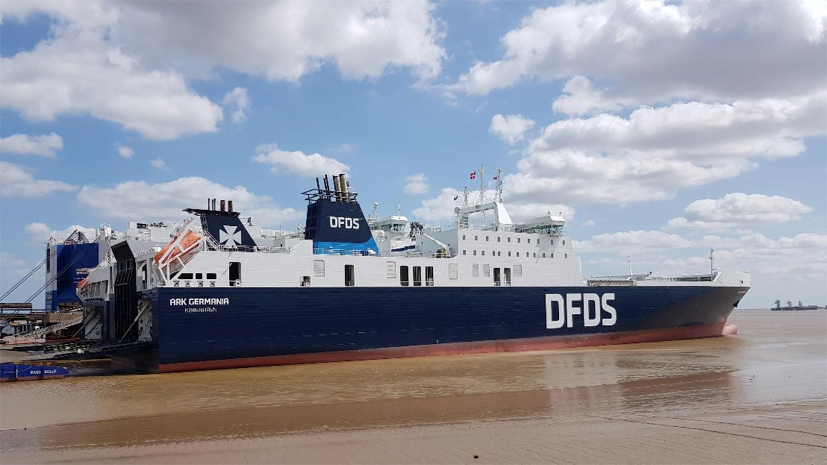
The onboard drone system will for the demonstration case be further developed and integrated with Wärtsilä’s existing system (SmartDock) which will be installed on one of the DFDS ships- ARK GERMANIA.
The drone will fly over the ship when in confined waters and when entering harbour, obtaining crucial precision points data from recognition of known landmarks in the surroundings, thereby generating the vessel’s absolute position. The ship’s navigation and position control system will receive the absolute position in a standardized format. This will allow the position to be blended into and used as any other existing position source for the navigation system.
The significance of achieving this lies with:
- Ease of integration. No major technical modifications are needed for the ship’s navigation system side to process this additional information
- The position accuracy would be comparable to GNSS or better, thus the same use can be made of it
- The position would be available in the same quality by two different means, thus the loss off a single position source would not endanger the functioning of higher-level control systems any more
- The position would be derived in a way which is immune to malevolent disturbances such as spoofing or jamming, thus would maintain the same function also in a for whatever reasons GNSS-denied environment
- All the above would be achieved with a self-contained shipboard system which does not require any external infrastructure to be installed, such as reflectors or transponders
Task partners
Upteko
DFDS
Wärtsilä Lyngsø Marine